For non-coders
From your analysis to a map you can publish.
Write what you want to show. Gesta Carta produces a coherent editorial map, editable in plain words — no cartography software, no retyping data by hand.
Open the Studio →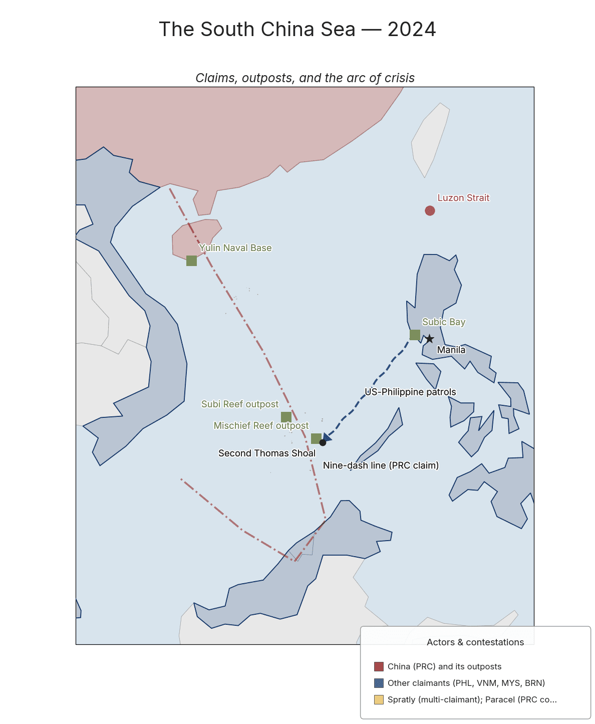
Three moves, not a line of code.
01
Describe, or upload.
A sentence, a spreadsheet, a supplier PDF, a photo of a label. The model reads it and pulls the right fields.
02
You stay in control.
Every choice is explicit — disambiguations, sources, time reference. Fix only what’s uncertain; nothing ships without your confirmation.
03
Export and publish.
Full PNG or SVG, editable, citable. Ready for an article, a deck, a report, a brief.
What you can do
- Edit in words: “make the Russian zone larger,” “drop Belarus.”
- Interactive canvas: click an element on the map to change it.
- Extract a draft from a text or PDF — even a historical one.
- Geocode place names and restyle with a single click.
- Export to PNG or SVG; copy the source document.
- Bilingual interface today, more languages coming.
Who it’s for.

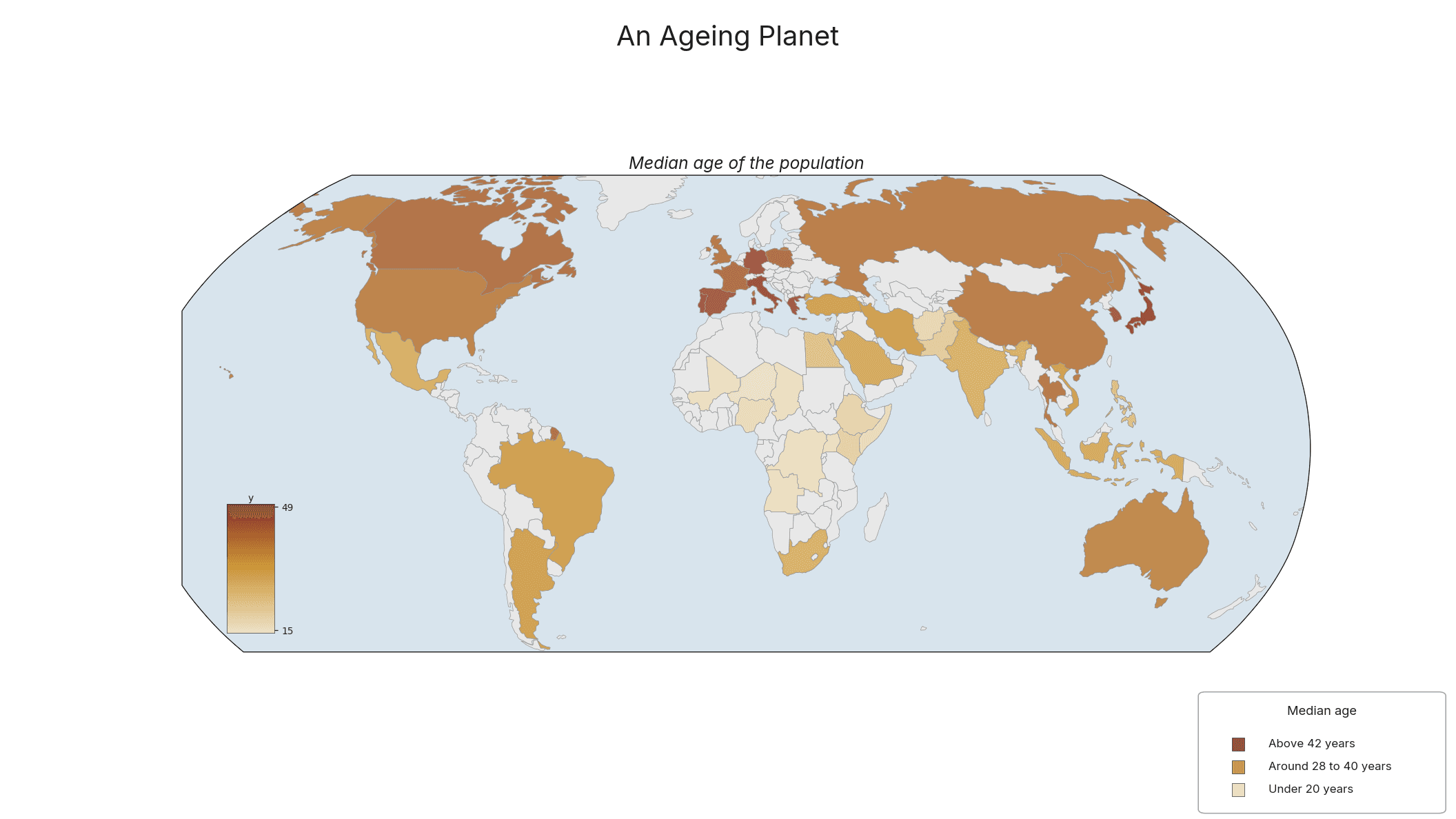
Analysts & researchers
Geopolitical and economic scenarios, made legible.
Newsrooms & journalists
Clean, citable maps in minutes.

Teachers & explainers
History, culture, environment in one visual language.
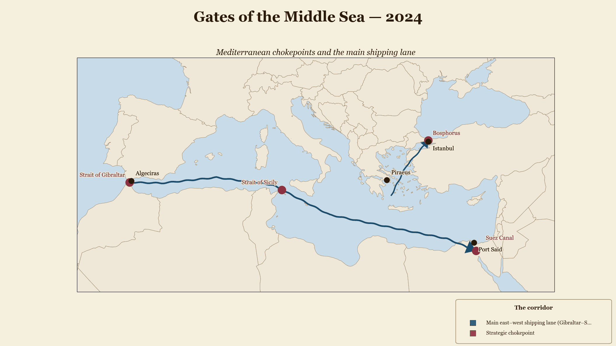
Briefers & defence
Reproducible, versionable plates.
The other doors